AMASE

The Swedish Defense Research Agency, FOI, is constructing an unmanned ground vehicle, UGV. Our assignment has been to develop a system that continuously provides the UGV with information about the surrounding scene; this information will be used to e.g. make decisions regarding collision avoidance.
To obtain information about the surrounding scene the system computes a point cloud from a stereo pair of images; further, the point cloud is updated periodically and new points are added with regard to the cameras new position.  Each point in the point cloud is represented in world coordinates relative the UGV. The system as a whole consists of two cameras and an inertial measurement unit, IMU, mounted on a rig and a computer.
For further information, read the technical report under documents.
Members: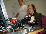
- Johan Hallenberg - Project manager
- John Wood - Documents
- Ove Svensson - Quality of system
- Mikael Karelid - Customer relations
- Magnus Dahrén - Design of system
- Jon Månsson - Testing of system